 Xpress News24
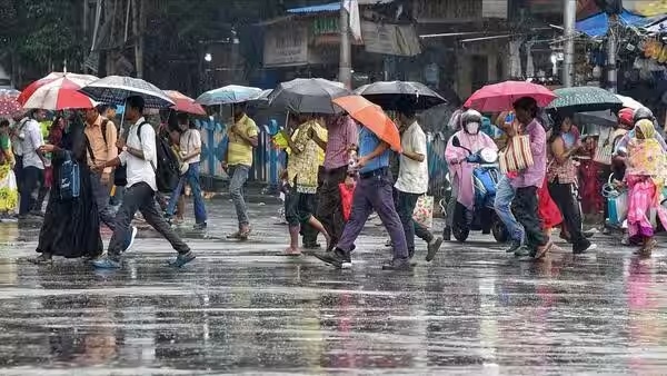
After a brief three-day lull, the monsoon is becoming active again across parts of central India. Madhya Pradesh is expected to see a fresh spell of rain, with the eastern districts likely to receive the strongest showers on Friday, September 11. The India Meteorological Department has also indicated renewed thunderstorm and rainfall activity in several parts of the country.
Eastern Madhya Pradesh to see stronger rainfall
The main impact on Friday is expected across eastern Madhya Pradesh, including Satna, Rewa, Mauganj, Sidhi, Maihar, Shahdol, Dindori, Anuppur, Mandla, Balaghat, Seoni and Chhindwara. Weather forecasts for Rewa and Mauganj also indicate the possibility of light to moderate rain and thunderstorms on Friday.
The renewed activity comes after several parts of the state experienced more sunshine over the past few days, leading to higher humidity and discomfort. A low-pressure system over the Bay of Bengal, along with the monsoon trough and associated circulation, is expected to support another round of rainfall.
The rainfall pattern is likely to gradually shift towards western Madhya Pradesh from September 12. Indore, Ujjain and Narmadapuram divisions could see an increase in rain activity as the system moves inland. This may provide some relief to areas that have so far received comparatively less rainfall.
UP sees scattered showers; lightning warning issued
Uttar Pradesh also witnessed the impact of the developing weather system on Thursday. Scattered rain and thundershowers were reported from parts of southern UP, eastern districts and the Terai region.
Lucknow, Varanasi, Prayagraj, Kanpur, Sonbhadra, Lakhimpur Kheri and Amethi were among the places where scattered showers were reported.
However, the latest IMD subdivision warning issued on September 10 does not show a warning for East or West Uttar Pradesh on September 11.
In Lucknow, several areas experienced a sudden spell of heavy rain during the evening. Hazaratganj, Kaiserbagh, Para and Sarojininagar received showers, while parts of Gomti Nagar and Indiranagar also witnessed rain later in the evening. The city had remained under a mix of sunshine and clouds earlier in the day.
Rajasthan prepares for another spell of rain
Rajasthan is also likely to see a change in weather after a relatively dry period. A new weather system developing over the Bay of Bengal is expected to influence rainfall activity across the state.
The eastern parts of Rajasthan could see rainfall activity beginning around September 11, with the possibility of wider coverage from September 12 onward. Jaipur, Bharatpur and Kota divisions are among the areas likely to see showers during the initial phase.
The IMD’s Jaipur forecast also indicates thunderstorms and rain activity from September 12, continuing over the following days.
During September 12–15, rainfall is expected to spread across more areas of Jaipur, Bharatpur, Kota, Udaipur and Ajmer divisions. Kota and adjoining areas could receive comparatively heavier rain on September 13 and 14.
Western Rajasthan may also see isolated showers later in the period, particularly across parts of the Jodhpur and Bikaner divisions.
With the monsoon becoming active again, residents in affected areas are likely to face sudden thunderstorms, lightning and short spells of intense rain. Authorities and residents are advised to follow the latest local weather warnings, particularly during thunderstorms.